Statistics Bureau

  • Inquiry
  • Site Map
  • Japanese
  • Inquiry
  • Site Map
  • Japanese
  • home home
  • Statistics Statistics
  • Public Relations Public Relations
  • FAQ FAQ
  • About us About us
close
  • Home
  • Statistics
  • Grid Square Statistics
  • Method of Demarcation for Grid Square
  • Chart for Method of Demarcation
  • Primary Area Partition of the Country

Main contents start here

Primary Area Partition of the Country

Primary Area Partition of the Country

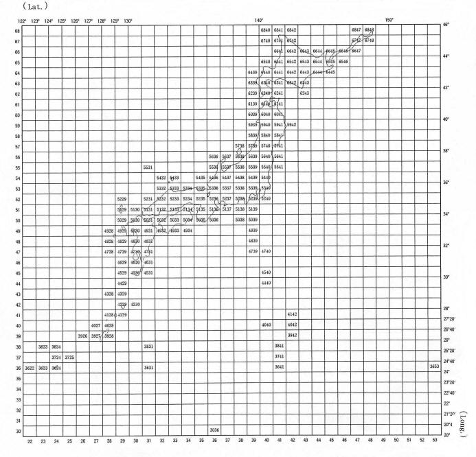
The range of the Primary Area Partition in Japan is between 20 degrees to 46 degrees north latitude and between 122 degrees to 154 degrees east longitude. The code is a 4-digit number that the first 2-digits is between 30 to 68 and the last 2-digits is between 22 to 53.

Back Home

Top of this page

19-1 Wakamatsu-cho, Shinjuku-ku, Tokyo 162-8668 Japan
©1996 Statistics Bureau, Ministry of Internal Affairs and Communications (JCN2000012020001)
  • Access Map
  • Information for use of this Website